• The World Bank Working for a World Free of Poverty
UAV STATE OF Play in Development
  • Overview
  • Sectors
  • Case Studies
  • About
UAVs are becoming an increasingly common tool in development and humanitarian programs, with a gradual shift towards more scaled operations. Like all other technologies and tools, the case must be made regarding return and value for investment in UAV deployments. Ultimately, appropriate uses of UAV technology should deliver superior program outputs as compared to alternative methods of data collection.
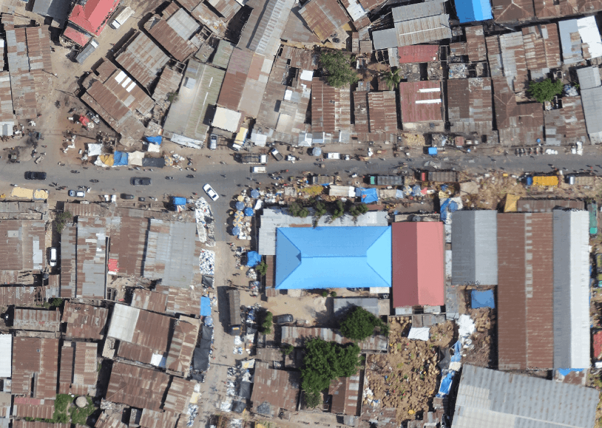
Credit: Mark Iliffe; Dar es Salaam, Tanzania

UAV & Development Sectors

UAVs intersect with broad sets of stakeholders, whose needs and positions should be identified as part of a complete planning process. These include local communities who are surveyed; local and national governments; and an assessment of in-country readiness and capacity to manage UAV deployments. Generally, in-country UAV equipment and processing capabilities are improving and becoming more common, meaning that the barriers to incorporating UAVs in projects are decreasing over time. UAVs have the potential to support progress across most of the SDGs, and are situated to play a role in improving lives around the world for decades to come. At this juncture, use cases are still being tested and analyzed, making it an exciting moment to participate in establishing the road ahead for UAVs, development, and humanitarian aid.

UAVs have applications across many different development sectors. Generally, practitioners turn to UAVs to provide actionable information during each stage of a project's development: from project planning to operations, communications, and monitoring.

UAV Applications by Sector

Agriculture | Education | Energy & Extraction | Environment & Natural Resources | Governance
Health, Nutrition & Population | Macroeconomics & Fiscal | Social Protection & Labor | Poverty & Equity
Social Urban Rural & Resilience | Trade & Competitiveness | Transport & ICT | Water


Picture

Agriculture

Most Common Uses

  • Accurately evaluating crop health
  • Distinguishing different crop varieties from one another
  • Making "big picture" assessments of land areas that are too large to quickly survey on the ground
  • Tracking and collecting livestock scattered across large geographic areas
  • Enabling crop spraying without the expense of hiring a manned aircraft or the danger of handling dangerous chemicals

Future Trends

  • Enabling agronomists to make more accurate crop growth projections
  • Identifying crop pests and areas of infestation
  • Dropping seeds from UAV platforms
Picture

Education

Most Common Uses

  • Fostering interest in science and technology in universities and in some lower-level programs
  • Helping students learn transferable skills by building "Do it Yourself" UAVs, both in class and in extracurricular and research projects
  • Students who know how to build and fly UAVs can then use these skills to secure good jobs in technology, and to create their own businesses.

Future Trends

  • Increase in the use of inexpensive DIY UAVs in the classroom, as a means of teaching engineering and electronics skills.
  • Schools with access to a UAV (or two) can use the data collected to do projects in geography, cartography, journalism, and other areas that are not explicitly rooted in engineering and in STEM
  • Developing UAV industry means students with these specialized skills will be at an advantage in the job market
Picture

Energy & Extraction

Most Common Uses

  • Conducting power line, pipeline, flare stack and wind turbine inspections at a greatly diminished expense and risk to technicians
  • Surveying existing mines in 2D and 3D; quick volume calculations
  • Mine planning
  • Efficient offshore oil and gas rig inspection

Future Trends

  • Seeking new mining and oil field sites over large, inhospitable areas (and identifying existing artisanal and small-scale sites)
  • Improved gas emissions monitoring
  • Earlier oil spill detection, over large areas
  • Soil sample collection and delivery, and other delivery functions focused on smaller and lighter objects
  • Site security management and support
Picture

Environment & Natural Resources

Most Common Uses

  • Wildlife monitoring and surveys, both by reserve rangers and scientific researchers
  • Detecting illegal deforestation in protected areas
  • Mapping different forest types, and monitoring logging efforts
  • Monitoring world impact of global warming, such as changes in sea ice
  • Collecting data about volcanic emissions
  • Ongoing monitoring of forest fires

Future Trends

  • Spotting and deterring wildlife poachers over large protected areas
  • Multi-year use of UAV imagery may aid in spotting macro-trends in climate change
  • Monitoring fisheries and protected marine areas
  • Collecting water, soil, and other biological samples for research
  • Tracking trends and changes in urban air pollution
Picture

Governance

Most Common Uses

  • Cadastral surveying in areas with outdated or non-existent records
  • Crop loss and property damage assessments for insurance payouts
  • Data to hasten financing for roads and other construction projects

Future Trends

  • Increased adoption by insurance agencies across different sectors
  • Regular cadastral surveys, at a lower cost than required by manned aircraft or satellites
Picture

Health, Nutrition & Population

Most Common Uses

  • Agricultural monitoring for food security purposes
  • Searching for mosquito breeding areas, as part of efforts to quash mosquito-borne illness
  • Some early warning systems for stressed crops, allowing farmers to respond quickly before crop failure takes place
  • Quick aerial settlement and population counts and evaluations, without expense of satellite imagery or manned aircraft
  • Early experiments with release of sterile or otherwise treated insects to combat pests

Future Trends

  • Increased use of UAV technology for epidemiological research and mapping
  • Delivery of lightweight medical supplies, and quick transfer of blood samples and medical tests from remote locations to testing centers
  • Transport of organs from one location to another
  • Use of sophisticated multispectral imagery for evaluating plant nutrition
Picture

Macroeconomics & Fiscal

Most Common Uses

  • UAVs have yet to be used to further program agenda in this sector

Future Trends

  • Delivery of financial documents and other physical documents in areas without access to roads
  • Monitoring migrant movement across favored ocean crossings
  • Reliable crop and agricultural forecasts, improving economic forecasts
  • Inexpensive inspections for faster property and infrastructure repairs
Picture

Social Protection & Labor

Most Common Uses

  • Track migrant movement across Mediterranean
  • Dangerous jobs, such as oil rig and power line inspection

Future Trends

  • Inexpensive civilian UAVs can be used to document human rights violations, illegal actions by private companies and other actors, and government excesses
  • Inspecting businesses and individuals suspected of using slave labor
  • Recording work-site violations by employers
Picture

Poverty & Equity

Most Common Uses

  • Inexpensively detecting illegal use of land claimed by indigenous people, minorities, and other disempowered groups
  • Enabling creation of updated cadastral surveys
  • Speeding creation of updated maps of swiftly-growing urban areas, helping city services expand to more residents

Future Trends

  • Increased use of UAV imagery for mapping temporary settlements, IDP camps, and expanding urban areas.
  • Improved documentation of land rights for populations subject to "land-grabbing" risk
  • Inexpensive source of aerial data and information, accessible to groups unable to afford or access relevant data
  • Creation of accessible technology jobs with lower barrier to entry
Picture

Social Urban Rural & Resilience

Most Common Uses

  • Immediate post-disaster mapping, hastening damage assessments
  • Search and rescue sweeps in aftermath of disaster
  • Mapping in months and years after disaster, smoothing rebuilding efforts
  • Collecting predictive data, such as flooding estimates, forest fire risk factors, and risk of bridge collapse based on stream and river debris

Future Trends

  • Reliable land mine detection at less risk to human surveyors.
  • Creating high-quality pre-disaster baseline maps for at-risk areas.
  • Radiation mapping in areas near nuclear sites
Picture

Trade & Competitiveness

Most Common Uses

  • New jobs with a lower barrier to entry than traditional aerospace
  • Participation in global market for both UAV hardware and software

Future Trends

  • Employment opportunities in a variety of industries (entertainment, construction, hobby, energy and extractive, surveying, research)
  • Competitive global market fuels technological innovation
Picture

Transport & ICT

Most Common Uses

  • Road and bridge inspections and evaluations
  • Railway inspections
  • Surveying in advance of new road and railway construction

Future Trends

  • Development of large unmanned aircraft capable of transporting humans
  • Tests of delivering cellular data to under-served areas from airborne UAVs
  • Creation of UAV delivery networks, moving from one "droneport" to another
  • Moving smaller cargo from large ships to port areas
  • At-sea emissions detection
Picture

Water

Most Common Uses

  • Evaluating climate-change based glacial melt and potential impact on future water supplies
  • Mapping at-risk areas to aid flood prevention and mitigation efforts
  • Irrigation monitoring for agriculture
  • Monitoring water supplies and water levels during drought conditions

Future Trends

  • Efficient water sampling & sample delivery for water quality evaluation
  • Monitoring and controlling damaging algae blooms
  • Accurate crop monitoring with UAV imagery can help farmers pinpoint where water is needed most, reducing their overall usage


Overview  |  Sectors  |  Case Studies  |  About

Site content is based on research from the World Bank and subsequent contributions from other authors. Please contribute improvements.
Site content is licensed CC-BY.

  • Overview
  • Sectors
  • Case Studies
  • About